
2. BACKGROUND
History
- Leighton Linslade is a civil parish comprising the market town of Leighton Buzzard and the settlement of Linslade, which was historically located in the county of Buckinghamshire. The parish is situated in Bedfordshire, England, in the southwest of the county and close to the Buckinghamshire border. It lies between Aylesbury, Tring, Luton/Dunstable and Milton Keynes, near the Chiltern Hills.
- It is sited in the centre of the country in gentle landscape close to the major Towns of Milton Keynes, Aylesbury, Bedford and Luton.
- It is 36 miles (58 km) northwest of Central London and linked to the capital by the Grand Union Canal and the West Coast Main Line. The built-up area extends on either side of the River Ouzel.
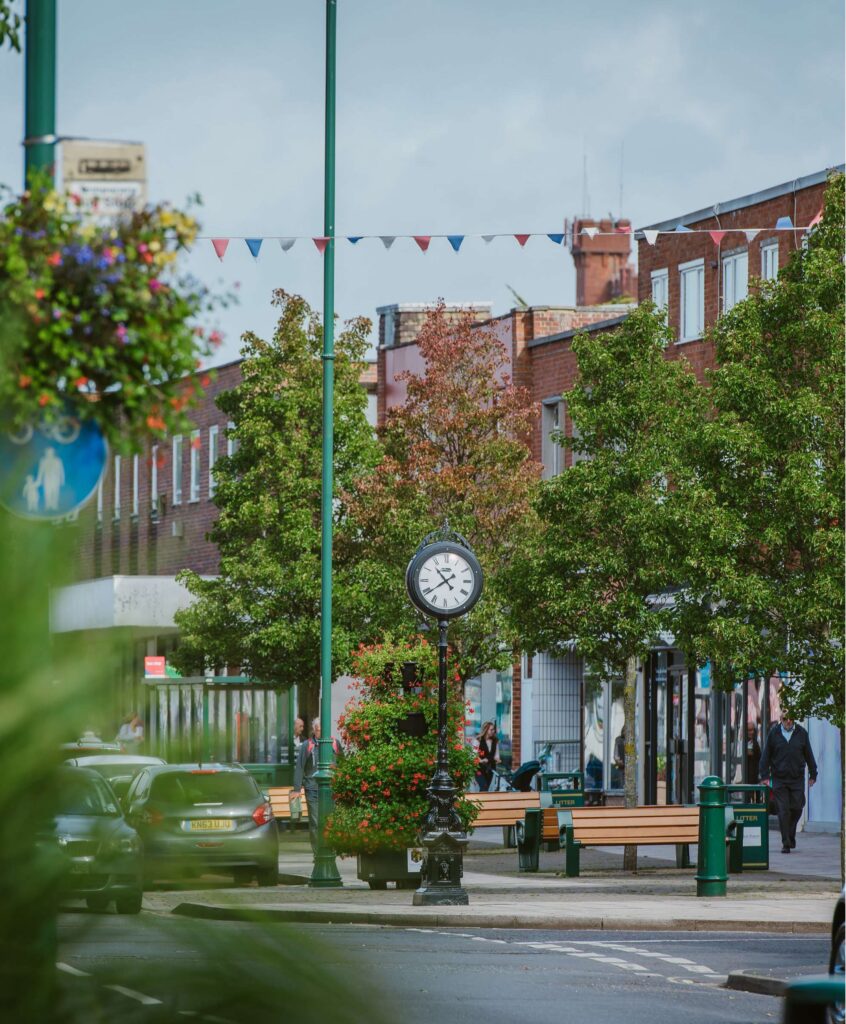
- Leighton Buzzard is a special town but not a town that shouts its presence.
- It is unclear when the town of Leighton Buzzard was initially founded, although some historians believe that there may have been settlement in the area from as early as 571. There are a number of theories concerning the derivation of the town’s name: ‘Leighton’ came from Old English Lēah-tūn, meaning ‘farm in a clearing in the woods’, and one version of the addition of ‘Buzzard’ was that it was added by the Dean of Lincoln, in whose diocese the town lay in the 12th century, from Beau-desert.[4] Another version is that having two communities called ‘Leighton’ and seeking some means of differentiating them the Dean added the name of his local Prebendary or representative to that of the town. At that time it was Theobald de Busar and so over the years the town became known as Leighton Buzzard. In the Domesday Book of 1086, Leighton Buzzard was called Leestone. A further variation may be seen in a legal record of 1424, where “William Dagenale of Leytun Busherd, Beds” appears as a defendant.
- Leighton Buzzard developed into a thriving market town supported by good road, canal and, later, rail links to the agricultural hinterland and London. The town’s market charter was granted in 1086 and is still active today. The High Street has numerous historical buildings, more than 70 of which are listed. They include the notable Bank Building on the Market Square designed by the eminent architect Alfred Waterhouse, designer of London’s Natural History Museum, London.
- The centre of the town retains the classic Y layout of a medieval market town. This is an essential element of the Town’s heritage which shapes the width and visual characteristics of the roads and buildings in the High Street. The building plots are narrow fronted but deep. The structures are generally on three levels with commercial use on the ground floor and domestic above. Above the commercial use the facades have a common unity and rhythm of domestic scale, materials and fenestration. The roof-scape is an impressive collage of red tiled pitched roofs. Two buildings are of particular national importance and heritage value; All Saints Church to the west and the Market Cross to the east.
- Leighton Buzzard has a rich history as a market town and described in the Domesday Survey as the richest market in Bedfordshire. The market cross in the town centre was built in 1453 and is a scheduled ancient monument. Industry in Leighton Buzzard included the basket making industry which starting around the mid-1700s and Lake Street was the centre of this industry. This industry grew through to the 1800s.
- The settlement of Linslade has also been known by several names throughout the centuries, having been recorded in the Anglo-Saxon Chronicle of 966 as Hlincgelad, in the Domesday Book of 1086 as Lincelada and eventually to Lynchelade and finally Linslade. The original St. Mary’s Church was built in 1151 by Simon de Beauchamp, but was rebuilt in the 15th Century. In 1251 a royal charter was granted to William de Beauchamp to hold a weekly market in Linslade on a Thursday. In the 13th century, large numbers of pilgrims were attracted to the Holy Well, the site of which is now being excavated.
- In 1785 it was described “as a pleasant and populous town agreeably situated on a branch of the river Ouse and rendered flourishing by a good trade and large markets.” These characteristics were maintained by the Georgian and Victorian additions to the town which included the narrow plot sizes, the passages through to the rear of the premises, the use of red brick or rendered facades, and the use of low rise tiled pitched roofs.
- These features have been maintained and currently, with minor exceptions, Leighton Buzzard has retained the best of its early origins with some notable buildings and cohesion of style and proportions of the classic medieval market town. The Town also has immediate access to the canal, river, water meadows, and the countryside for both pedestrians and cyclists.
- These traits and features are of great value and should be fostered in any new development within the Town Centre and in the vicinity of the High Street.
- The Junction Canal was dug through Linslade parish and opened at the start of the 1800s and linked London with the Midlands. The London and North Western Railway line opened in 1838 with trains stopping at Linslade on the line between Euston and Manchester. The Wool Fair began in 1840.
- The railway and canal in Linslade prompted a new population to grow up around this area – people were reluctant to travel the two miles to St Mary’s Church in Old Linslade so a new church, St Barnabas was built across the meadow from the railway station in the area of New Linslade known as Chelsea New Town. A second LNWR railway line opened in 1848 between Leighton Buzzard and Luton.
- The settlement has had a long association with the Rothschild family, since Lionel de Rothschild bought neighbouring farmlands to the west of the town in 1873. Over time the farm developed into the Ascott House estate located less than 2 miles (3 km) from the town. In the late 19th century, Baron Ferdinand de Rothschild used the now demolished Leighton House and its stabling, on the High Street, as a hunting box.
- The Corn Exchange was built in Lake Street in 1862. In 1965 Leighton Buzzard and Linslade amalgamated to form Leighton Linslade Urban Council and by an Act of Parliament Linslade was transferred from Buckinghamshire to Bedfordshire. Subsequently, Leighton-Linslade Parish (Town) Council was formed in 1974. Leighton Linslade Southern Bypass opened in 1991.
- Today the town continues to grow and is expanding predominately eastwards, with several developments forming the Eastern Leighton Linslade Urban Extension Scheme. This growth has been substantial and sustained: the 2011 Census recorded a total population of 37,470 with 15,680 households and 16,410 dwellingsCentral Bedfordshire Council, and by the time of the 2021 Census the population of the parish had risen to 42,392, with estimates placing it at around 43,815 by 2024Homemove, reflecting a significant upward trajectory driven by ongoing housebuilding.
- The strategic framework for this eastward expansion was established when the East Leighton Linslade Framework Plan was adopted for development management purposes in May 2013, setting out the vision for the urban extension and identifying the indicative location of infrastructure and land uses.
- The strategic framework set out the needs for Healthcare, Leisure and Recreation and Community Use facilities to be delivered within the town through these developments, but those developments have in many cases not been brought forward with the new development.
- While Leighton-Linslade has seen a significant increase in housing, local residents consistently feel that the infrastructure to support the increased population has not been delivered alongside it. There is an active Health Campaign group that has seen significant engagement from local residents in their campaign for improved health facilities, and throughout the engagement with local residents with the Neighbourhood Plan, the lack of health and community facilities in the town has consistently been brought up. While the ICB has updated a health centre in the town, feedback from local residents has been that it lacks proper access and parking, and is not a suitable site for a busy facility. This feedback from local residents drives the desire to see well planned out local facilities delivered in the heart of the town centre, which is served by local bus services as well as having parking provision and is accessible to residents from across the town. This also serves to support the community cohesion of the town through supporting the viability of the town centre.
- The town has a strong sense of community with local events in the town centre being actively supported and having high turnouts across the year. Being able to support and develop that sense of community is an important driver to the plan’s desire to see the town centre develop in a way that brings additional value to the town, supporting the town centre businesses, local community groups and services through mixed-use development that builds on the town’s history and historic buildings.
Profile
- The population of Leighton Linslade was 42,392 in 2021 growing from 37,469 in the 2011 census and 32,417 in 2001. This number continues to increase with the build out of strategic housing developments predominately to the east of the parish. The parish has a slightly younger age profile than the national average, although the 15 – 25 age group is below the average, with those in the 30 – 45 category representing the largest demographic, which may reflect the attractiveness of the area for families, particularly those starting a family or with younger children. It may also reflect the attractiveness of the parish for professionals who may work locally or in the surrounding area, given the strong employment offer or the commute into London. Indeed, over 67% are considered economically active, well above the national average, with only 2.5% unemployed, which is consistent with the age profile. With its population growth, the town has become more culturally diverse, adding to the rich tapestry of the local community.
- There are comparatively fewer flats and apartments (17.8%) compared to the national average (22.2%) which may also align with the larger development locations outside of the town centre, which continue to be built as 2-, 3- and 4-bedroom houses. Leighton Linslade is also considered a healthy place to live, with the data indicating that over half of the population are in very good health, with less than 4% in bad or very bad health.
Strategic Planning Policy
- Whilst no longer a basic condition requirement, the LLNP has been prepared to be in general conformity with the strategic policies of the Central Bedfordshire Local Plan 2015 – 2035.
- The key policies affecting Leighton Linslade are:
Central Bedfordshire Local Plan (2015- 2035)
- Policy H1: Housing Mix
- Policy R1: Ensuring Town Centre Vitality
- Policy R3: Town Centre Development
- Policy T2: Highway Safety and Design
- Policy T3: Parking
- Policy EE1: Green Infrastructure
- Policy EE2: Enhancing Biodiversity
- Policy EE3: Nature Conservation
- Policy EE12: Public Rights of Way
- Policy EE13: Outdoor Sport, Leisure and Open Space
- Policy CC1 Climate change and sustainability
- Policy HQ1: High Quality Development
- Policy HQ2: Developer Contributions
- Policy HQ3: Provision for Social and Community Infrastructure
- Policy HQ9: Larger Sites, Development Briefs and Design Codes
- Policy HE3: Built Heritage
- Central Bedfordshire Council is bringing forward a new Local Plan, which will be prepared under the new 30-month Local Plan system. This process is due to commence shortly with a scoping consultation being undertaken during May 2026 with the first formal consultation due towards the end of the year.
- The CBC Local Transport Plan LTP3 (2011 – 2026), includes a number of strategies that are relevant to this Neighbourhood Plan. Of particular relevance are the following:
- Sustainable Modes of Travel to Schools Strategy (draft)
- Active Travel Strategy (draft)
- Parking Enforcement Strategy
- On Street Parking Management Strategy
- Parking Standards for new developments (SPD)
- Transport Strategy LPT4 is due to be consulted upon by Central Bedfordshire Council in 2026. However, a number of other policy documents of relevance have been produced since LTP3’s adoption, including:
Leighton Linslade Local Cycling and Walking infrastructure Plan,
Freight Strategy
The Bus Service Improvement Plan
Electric Vehicle Infrastructure Strategy. - Links to all of the documents above can be found on the Central Bedfordshire Council website or the documents section of the Leighton Linslade Neighbourhood Plan website.
National Planning Policy
- The LLNP also has to have regard for national planning policy and guidance as set out in the National Planning Policy Framework (NPPF) and supporting Planning Practice Guidance. The Basic Conditions Statement contains full details on how the Plan is consistent with both the current 2024 NPPF but also the draft 2025 NPPF, with particular reference to the National Decision-Making Policies contained therein, to ensure the Plan has functional weight after adoption.
- The LLNP must demonstrate how its policies contribute to the achievement of sustainable development and how they will not cause any harm to important ecological areas (in respect of the Habitats Regulations). A Strategic Environmental Assessment (SEA) and Habitats Regulation Assessment (HRA) have been prepared to support the LLNP and accompany this submission version of the Plan. These matters are also addressed in the Basic Conditions Statement.
- In respect of the changes to Basic Conditions introduced in March 2026 in The Levelling-up and Regeneration Act 2023 (Commencement No. 11 and Saving and Transitional Provisions) Regulations 2026 enacting sections 98 and 99of the Levelling-up and Regeneration Act 2023, the LLNP is able to demonstrate compliance with the new requirements in respect of mitigation and adaptation to climate change and having regard to the Local Nature recovery Strategy. This is set out in the Basic Conditions Statement alongside evidence to support that the making of the neighbourhood development plan would not result in the overall development plan for the area proposing less housing than if the neighbourhood development plan were not to be made. (This replaces the former Basic Condition that the neighbourhood plan be in general conformity with the strategic policies contained in the development plan for the area.)[1]
[1] Basic Condition ‘(e)’ is replaced by ‘(ea)’.
Project Progress
- A first early engagement exercise was carried out by the Town Council in February 2024 which included drop-in sessions and an on-line survey, to help shape the scope of any neighbourhood plan. Following the completion of the scoping report, the Town Council approved the preparation of a Neighbourhood Plan in June 2024 and the submission of an application to designate the Neighbourhood Plan area.
- The Town Council advertised the formation of the Steering Group and Tasks Teams in summer 2024, seeking expressions of interest from the local community to join one or more group. The volunteers were formally appointed in September 2024, at which point research and evidence gathering began. Steering Group meetings were held every six weeks and task teams met on a more informal basis as needed, continuing until March 2025.
- An informal engagement exercise took place from 17th March to early May 2025 to test the emerging policy intent and help refine the policies prior to drafting of policy wording. Again, this took the form of a survey, drop-in sessions as well as more targeted meetings with key stakeholder groups. The results of both the 2024 and 2025 engagement exercises can be found on the website and in the consultation statement which LLTC will publish as part of the submission documents. This will summarise the nature and outcome of the informal engagement and statutory consultation activities and how they have informed the LLNP.
- Following a review of the informal engagement responses, a first draft of the plan was prepared in June 2025 for initial review by the Steering Group. Further iterations of the pre-submission version of the plan continued to be refined over the summer months, in preparation for approval by the Policy and Finance Committee on the 15th September with further ratification by the Town Council at the end of September, ready to commence the Regulation 14 consultation stage.
- The Regulation 14 consultation ran from Monday 13th October to Sunday 30th November 2025. A report on the representations made was prepared and presented to the Steering Group in December with a first draft of the submission plan subsequently prepared for sign off by the Steering Group in March 2026. The Plan is tabled for approval by Policy and Finance Committee in April 2026 with the final version seeking approval by Full Council prior to submission.