
POLICY LL9: Local Green Spaces
The Neighbourhood Plan designates as Local Green Spaces, the locations listed below, shown on the Policies Map and detailed in Appendix D, for the purpose of applying the National Decision-Making Policy HC8 on development affecting a Local Green Space:
- Heath Wood
- Heath Wood Meadow
- Knolls Wood
- Churchill Road Amenity Space
- Nelson Road Play Area
- Linslade Wood
- Alwins Field Allotments
- Derwent Road Recreation Space
- Mentmore Road Memorial Playing Field and Gardens
- Wyngates Allotments
- Ledburn Quarry
- Tiddenfoot Waterside Park
- Rackley Hill Pit
- Camberton Road Informal Recreation Space
- Weston Avenue Playing Field
- Weston Avenue Allotments
- Pages Park Recreation Ground
- Astral Park
- Stanbridge Meadows
- Danes Field
- Vandyke Rd Recreation Ground
- Dunnock Drive Informal Recreation Space
- Field adjacent to Linslade Wood (off Stoke Road)
- Amenity Space between Regents Street & Miles Ave
- Meadow Way Recreation Ground
- Alwins Field Recreation Ground
- Chelsea Green
- Soulbury Road Verge Amenity Green Space
- Bideford Gardens Amenity Green Space
- Grasmere Park Amenity Green Space (west)
- Grasmere Park Amenity Green Space (east)
- Leeston Park Play Area
- Liddell Way Green Space
- Leighton Road/Meadow Way Amenity Green Space
- Adams Bottom Green Space
- Vandyke Loop Meadow
- Aurora Rise Informal Recreation Space
- Parson’s Close Recreation Ground
- Linslade Recreation Ground
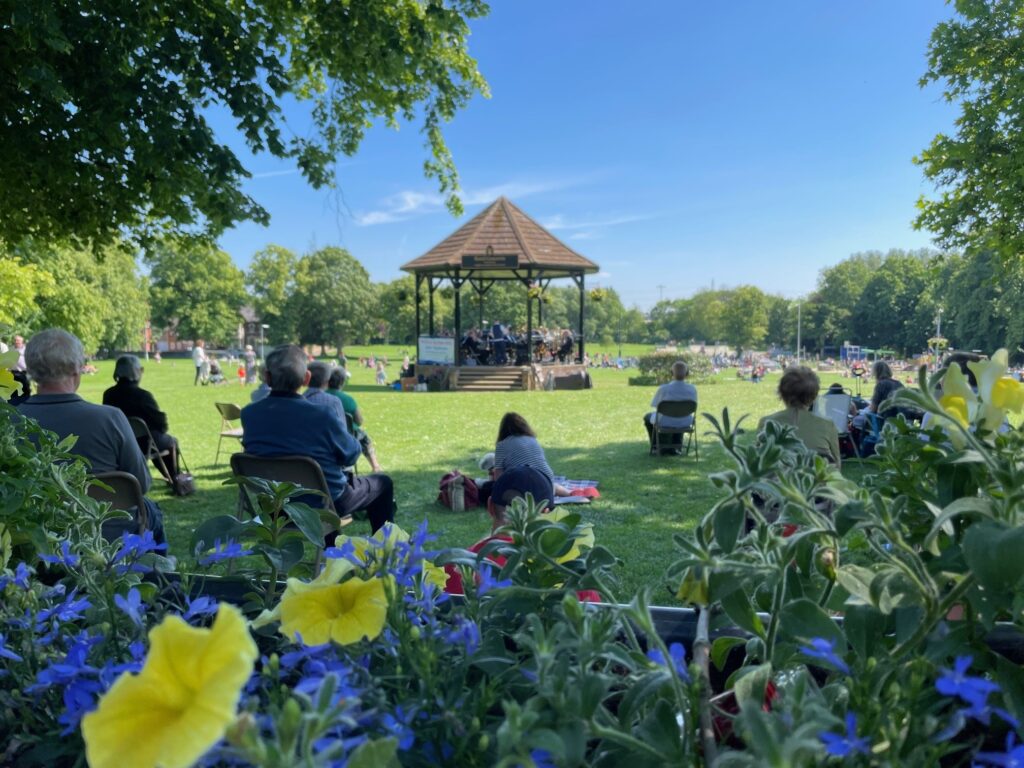
The Leighton Linslade Green and Blue Infrastructure Network includes some land that qualifies as a Local Green Space; this places play an important role in Leighton Linslade, helping to define the character of the area, as well as being an important social and environmental resource for the health and wellbeing of the community.
In 2012, the National Planning Policy Framework (NPPF) introduced Local Green Space as a way for communities to identify green areas of particular importance and to provide special protection against development. They can only be designated through either Local or Neighbourhood plans. The principle of Local Green Space has remained unchanged in subsequent updates to the NPPF (including the draft 2025 consultation version) which states that policies for managing development within a LGS should be consistent with that for the Green Belt.
Jon Balaam of the Greensand Trust, as part of the Steering Group Task Team and appointed by the Town Council to develop the Green and Blue Infrastructure Plan, completed a two stage evaluation of candidate LGS sites. Stage I initial screening was completed prior to the informal engagement in March/April 2025, with Stage II being completed before the Pre-Submission Plan was approved for the Regulation 14 Consultation. A further review was undertaken in preparing the submission version of the Plan to revisit those sites where objection was raised. The approach taken is considered appropriate and proportionate.
These designations offer protection against development for community-valued green spaces which provide significant recreational, ecological, and aesthetic benefits.
Local Green Spaces, by virtue of their proximity and community value, are particularly important in ensuring that these health benefits are available equitably, including to those with limited mobility, lower incomes or without access to private gardens. Policy LL9 therefore support a preventative, place-based approach to public health by safeguarding Local Green Spaces as essential social infrastructure that underpins long-term physical, mental and environmental health outcomes for the community.
Each location has been justified using the National Planning Policy Framework criteria that the location shall be:
- in reasonably close proximity to the community it serves;
- demonstrably special to a local community and holds a particular local significance, for example because of its beauty, historic significance, recreational value (including as a playing field), tranquillity or richness of its wildlife; and
- local in character and is not an extensive tract of land.
The Planning Practice Guidance provides a helpful steer as to the considerations for Local Green Space identification. Green areas can include land where sports pavilions, boating lakes or structures such as war memorials are located, allotments, or urban spaces that provide a tranquil oasis. The proximity of a Local Green Space to the community it serves will depend on local circumstances, including why the green area is seen as special, but it must be reasonably close. For example, if public access is a key factor, then the site would normally be within easy walking distance of the community it serves. There are no hard and fast rules about how big a Local Green Space can be because places are different, and a degree of judgment will inevitably be needed. Because Local Green Space designation should only be used where the green area concerned is not an extensive tract of land, blanket designation of open countryside adjacent to settlements will not be appropriate. Finally, there is no requirement for the Local Green Space to have public access.
Full details of every location are set out in Appendix D to describe why each is special.
To see the full Leighton-Linslade Neighbourhood Plan Policy Map, or to find instructions about how to use our interactive maps, please visit our Policy Map page.